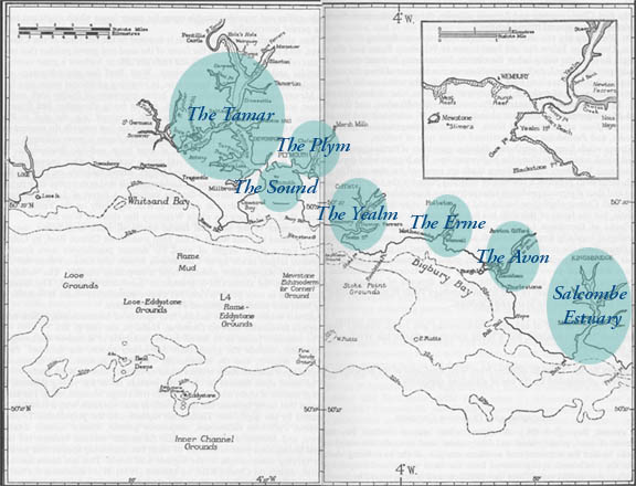
The approximate geographic coverage of the
Plymouth Marine Fauna.
Shaded areas are hyperlinked to associated textual descriptions below.iginal illustration
from the 1957 ed
| Updated Locations |
| The Tamar | |
| The Tamar is the largest estuary which empties into Plymouth Sound. It is tidal for approximately 30 kms and the rivers Lynher and Tavy flow into it (Hiscock et al., 1986). In the upper reaches around Cotehele Quay there are oak and beech woodlands, whilst a few miles downstream mudflats support a variety of birdlife. As the river broadens, the banks become dominated by reed beds (Foot, 1989). Along the lower estuary at Devonport is the Royal Naval Dockyard and the area has many jetties and walls. On the opposite side of the river the land is comparatively less disturbed. There are extensive mudflats around the mouth of the Lynher. | |
Ferries transporting vehicles regularly run between Torpoint and Devonport. In addition to the slipways there are also small areas of shingle shore to be found. |
|
A more detailed description of the Tamar may be found in Hiscock et al., 1986. |
|
| MAP | |
| The Tamar Estuary since 1957 | |
| In the Plymouth
Sound and estuaries area there has been an increase in recreational water use and the size
and number of naval vessels has changed since 1957 (pers. comm. Lt Cdr Simon Gooder,
1998). There are a number of diving, canoeing, sailing and rowing clubs who utilise the
area, as well as anglers, jet skiers and water skiers. Some areas are designated for
particular activities, for example Barn Pool, near the mouth of the Tamar is used as a
training area for commercial divers, however no diving is permitted in the St. John’s
Lake area (The Port of Plymouth Water Events Diary and Handbook, 1998). With greater numbers of yachts, the number of private moorings has increased in the Tamar, especially in the Saltash and Weir Quay areas (Review of Port of Plymouth Area Recreational Study, 1992). Close to the estuary entrance is Mayflower International Marina, which was built in the early 1970s. Next to the marina at Stonehouse Pool there are dry moorings, which tend to be used by locals with smaller, older boats. Other moorings are found at the Torpoint Yacht Harbour and there are also a few in the river Lynher and at Cargreen. At Millbrook Lake and in an area just below the Tamar Bridge there were naval moorings, but many of these have been lifted due to the reduced numbers of naval vessels. Around Bull Point (just below the bridge) the navy has also removed a small jetty and cleared the area of ammunitions. There are still ammunition barges above the bridge and the area is dredged. Channels are surveyed in order to determine whether dredging is necessary and the Queen’s Harbour Master, Plymouth holds records of dredging activity. In the area of the Narrows, no dredging occurs due to the high velocity of the water, however the main approach channel was last dredged in 1995 and will be again in 2005, if necessary. Weston Mill was last dredged in 1996 and may next be dredged in the year 2000 (pers. comm. Lt Cdr Simon Gooder, 1998). The growth in car ownership has led to improvements in access into and out of Plymouth. The Tamar Bridge at Saltash was constructed in 1961 and the Torpoint Ferries have been increasing in size. Access to the waters has also increased with a number of slipways being constructed, for example at Cargreen in 1992 and at Richmond Walk beside Mayflower Marina. The Naval Dockyard at Devonport was
established in the 1690s and has been developed over a number of years and now covers 4kms
of shoreline (Hiscock & Moore, 1986). In the 1970s submarine and frigate facilities
were built and the Weston Mill Lake jetty was developed in the 1980s. Although the number
of naval vessels at Devonport has declined, their size has increased. With this increase
in size, the vessels have a greater draft and hence there maybe greater disturbance of the
seabed. During the late 1980s closed sewage systems were developed, which reduced raw
discharges from naval vessels into the environment. Nuclear submarines were introduced in
the late 1960s and today are extremely tightly controlled. A Submarine Refit Complex was
built between 1970 and 1980 on the north-western corner of the Keyham extension near
Weston Mill Lake (Duffy et al., 1994). |
|
| Tamar Estuary | |
Plymouth Sound |
|
| Plymouth
Sound is a ria or drowned river valley and the area has been designated as a Special Area
of Conservation. Most of the shore is steep and made of hard substrate. There are a few
small sand and pebble beaches. Limestone rock is found along the Hoe area and the north of
the Sound. A number of caves and gullies also exist. In the outer Sound and along the open
coast there are long stretches of broken slate reefs (Tamar Estuaries Consultative Forum,
1998). MAP |
|
| Changes
in the Plymouth Sound area since 1957 |
|
| Plymouth Sewage Treatment Scheme | |
| South
West Water’s ‘Operation Clean Sweep’ aims to improve the water quality in
"designated bathing waters" and Plymouth’s coastal area has a new sewage
treatment works. Part of the scheme involved the construction of a tunnel from Devonport,
via Millbay and the city centre to Cattedown treatment works (Water Events Diary and
Handbook, 1998). The discharge of crude sewage from the 23 outfalls will be halted and the
treated waste water will be discharged through the existing West Hoe outfall. The sewage
undergoes full preliminary, primary and biological secondary treatment and disinfection
using ultraviolet light (South West Water, January, 1998). Much of the work was completed
in June 1998 and full completion is expected in December 1998. An extension to the works
will be the construction of pumping stations behind the dockyard by the end of the year
2000 to meet the requirements of the Urban Waste Water Treatment Directive (pers. comm. N.
Gough, South West Water, 1998). MAP |
|
| Millbay Docks | |
| These
docks were used by cargo vessels, but since 1972 the cross channel ferries, owned by
Brittany Ferries, mainly transport passengers and vehicles (Duffy et al. 1994). There are
also a number of private berths belonging to the residents of a marine village on the West
Hoe side of the docks. MAP |
|
| Millbay Channel Millbay Pit |
|
| Plymouth Hoe | |
| The
Hoe foreshore has had very little maintenance work carried out on it and hence is
gradually being eroded. The Tinside pool is in a state of disrepair and access to part of
the Hoe below the Marine Biological Association is unsafe. MAP |
|
| Hoe Foreshore Channel below the Hoe Tinside |
|
| Area between Drake’s Island and The Breakwater | |
| There
has been a revised configuration of the Royal Naval Buoys and dredging occurred in the
1990s. An extra buoy was also added (pers. comm. Lt Cdr Simon Gooder, 1998). The Breakwater, which protects the Sound, is
regularly inspected for damage and repair work is carried out when necessary. On the
seabed around the fort lies a small vessel and blocks which are used by both recreational
and commercial divers. |
|
| North of Drakes Island Northern side of the breakwater |
|
| Plym Estuary | |
| Man made embankments and buildings have gradually been developed along the banks of the estuary over a number of years. There are only a couple of areas which have retained their naturalness in the upper reaches; Blaxton Meadow is managed by the National Trust and in 1994 the embankment was broken to make a sill, hence the meadow was turned back into a tidal marsh (Gill, 1997). Woodland borders the estuary at Saltram and these too belong to the National Trust. Above the Laira Bridge are some rich mudflats (Hiscock et al., 1986). | |
| The
lower part of the estuary has for a long time been of importance to commercial shipping
and fishermen, hence there are a number of wharves, harbours and marinas. MAP |
|
| Changes
in the Plym Estuary area since 1957 |
|
| Sutton Harbour | |
| The harbour is used by both fishermen and private yacht owners and the
area has undergone some dramatic changes since 1957. Approximately
5,000 square metres of land has been reclaimed since 1992 and the marina, which was built
in 1986, is no longer tidal (Evening Herald On the Waterfront, 1998). In the early 1990s
lock gates were constructed at the harbour entrance as a flood alleviation measure and
they also allow pedestrian access between the Barbican and Coxside. The Sutton Marina
provides about 350 permanent berths (Review of the Port of Plymouth Area Recreation Study,
1992). The marina was refurbished in 1998 by the owners the Sutton Harbour Company. The
pontoons were replaced and the number of berths available for 30ft plus boats was
increased. A new hoist which is able to lift the largest of boats at the marina and an
enlarged hard standing area are also under construction (The Port of Plymouth Water Events
Diary and Handbook, 1998). The
Barbican Fish Market was relocated to an area of reclaimed land area on the opposite side
of the harbour at Coxside, in 1995 (pers. comm. Ltd Cdr Simon Gooder, 1998). |
|
| Cattewater | |
| The number of yachts using the area has increased since 1957. Not only are
there new marinas at Queen Anne’s Battery and at Mount Batten, but many more
moorings. Oreston has 180 moorings, Hooe Point 63, Commercial Wharf 48, the northern side
of Mount Batten 26, Shore Store (just below the Laira Bridge) has 70 moorings and at
Pomphlett Lake there are 100 (pers. comm. Tim Charlesworth, 1998). MAP |
|
| The marina at Queen Anne’s Battery was constructed in the late 1980s
and is protected by a breakwater. It has over 300 permanent berths and 150 visitor berths
(Review of the Port of Plymouth Area Recreation Study, 1992). The Mount Batten Peninsula area is currently
undergoing redevelopment from an RAF camp to a sailing and watersports centre. There will
be a new 450 berth marina with deep water dock. The Watersports Centre will be ready by
the spring of 1999 for canoeists, water skiers, divers, anglers and sailors. There are two
slipways and hardstanding areas for boats (The Port of Plymouth Water Events Diary and
Handbook, 1998). This development reflects the increasing recreational use of the Plymouth
area. |
|
| The
Mount Batten breakwater was restored in the early 1990s. |
|
| Commercial shipping docks along the northern bank of the Cattewater. The
style of shipping changed during the mid 1950s-60s. The vessels became smaller and there
are fewer of them visiting the docks. A wide variety of materials are transported,
including oil, clay, paper, fish, cement and timber. Raw discharges from the ships are
becoming less common as improvements are made on the sewage systems (pers. comm. Tim
Charlesworth, 1998). The channels are surveyed every year and are dredged if necessary Prince Rock Power Station was built in 1899 and shut down in 1974 there may have been a discharge of warm water into the estuary (pers. comm. Tim Charlesworth, 1998). The new sewage treatment works has now been developed in this area. At nearby Cocklebank land is currently being reclaimed for light industrial use (pers. comm. Tim Charlesworth, 1998) Hooe Lake had a stone quarry nearby, which is no longer in use. The quays are disused and there maybe some silting up occurring (pers. comm. Tim Charlesworth, 1998). The main developments that have occurred in
the region above the Laira Bridge include the construction of the new flyover for traffic
on the A38 at Marsh Mills in the late 1980s and the sewage works (Gill, 1997). Another
major change has been the construction of the dual carriageway, in 1970-71, between the
end of the Embankment and Marsh Mills. The spoil was then used to reclaim land between
Arnold’s Point and the Laira Bridge. Chelston Meadow in the past has been an area
with fresh and saltwater pools and a watermeadow (Tamar Estuaries Consultative Forum,
1998), however since 1964 it has become a tipping area (Gill, 1997). |
|
| Cattewater Mallard Shoal Rum Bay |
|
| The Yealm Estuary and Wembury | |
| The
Yealm is a narrow, wooded, steep sided inlet which is roughly 6.5km long. There is a
limited amount of freshwater inflow and the sand bar at the mouth shelters the lower
estuary from wave action caused by the prevailing south westerly winds. There is a
seagrass bed at Misery Point which has been studied by students at Plymouth University.
The estuary is also a bass nursery area. Just beyond the mouth is Wembury Voluntary Marine Conservation Area. The estuary is a proposed SSSI, is part of the Plymouth Sound Special Area of Conservation and is an Area of Outstanding Natural Beauty (Tamar Estuaries Consultative Forum, 1998). The marine life at Wembury has been well
studied for many years, especially the reefs. The gullies and ridges provide some
protection from wave action for a variety of organisms. There are two fresh water streams
which flow over the tidal zone, hence creating a greater diversity of habitat (Tamar
Estuaries Consultative Forum, 1998). |
|
| Changes
to the Yealm Estuary since 1957 |
|
| In 1957 there were a scattering of moorings for the few visiting yachts,
however today this has changed dramatically (pers. comm. Mike Simpson, 1998). There are
approximately 600 moorings leased by the Harbour Authority and about 60 private moorings
in the upper reaches (Draft Management Plan for the Yealm Estuary, 1997). Between the
months of April and October the estuary is at its busiest (pers. comm. Mike Simpson,
1998). Due to the greater numbers of yachts, two lines of detached pontoons have been placed in the estuary. The one in the main pool is 150ft long and the one towards Kitley is 120 ft long. Yealm Quay was developed in the mid 1970s. The increasing use of the coastal path has led to a small passenger ferry being established to take people across Yealm Pool (pers. comm. Mike Simpson, 1998). There are a number of public access points along Newton Creek, the most used one being Yealm Steps. Yealm Steps are owned and maintained by Newton and Noss Parish Council (Draft Management Plan for the Yealm Estuary, 1997). Although there is a high level of boating activity, no jetskis or water skiing is allowed within the jurisdiction of the River Yealm Harbour Authority (Draft Management Plan for the Yealm Estuary, 1997). A small laboratory was established by The International Paint Company in 1920. They have three testing rafts along the estuary, one at Misery Point, one at Warren Point and one opposite Madge Point (pers. comm. Mike Simpson, 1998). Every April there is an ‘Harbour Clean-up’ which involves the community and the Harbour Authority (Draft Management Plan for the Yealm Estuary, 1997). In 1977 a sewage scheme reduced the raw discharges into the estuary (pers. comm. Mike Simpson, 1998). In an area just down from Steer Point lie oyster beds (pers. comm. Rodney Bastard, 1998). No dredging occurs in the Yealm (pers. comm. Mike Simpson, 1998). |
|
| Yealm sandbank Eastern shore between Newton Creek and Misery Point Steerpoint flats Channel below Newton Creek |
|
| Erme Estuary | |
| The
Erme is slightly broader than the Avon and is approximately 6.5km long. It opens onto
sandflats and has steep wooded banks and saltmarshes up the estuary. Due to the settling
of sediment, the channel becomes very shallow at low water (Moore, 1988). The Flete Estate have restricted public access and
maintain the unspoilt character of the area, which is part of a SSSI (Moore, 1988). |
|
| Changes in the Erme Estuary since 1957. | |
| The Erme estuary is owned by the Flete Estate which ‘manages the area
so as to preserve its natural beauty and peaceful character’ (Moore, 1988). The
estuary has changed very little since 1957 (pers. comm. A.J.B. Mildmay-White, 1998).
Public access is limited and there are no major developments along the banks. The main
recreational use is by bathers on the shores at the estuary mouth. There are still only 25
moorings and jet skiing and water skiing is discouraged (pers. comm. A.J.B. Mildmay-White,
1998). There are two discharges into
the Erme. A small one from the Flete Estate and another from Holbeton sewage treatment
works (Moore, 1988). Holbeton Sewage System is due to be improved within the next 5 years
(pers. comm. A.J.B. Mildmay-White, 1998). There was an
oil pollution incident in 1990, but the estuary seems to have fully recovered from it
(pers. comm. A.J.B. Mildmay-White, 1998). |
|
| Avon Estuary | |
| This estuary runs through a narrow valley and opens into Bigbury Bay. It
is 7km long and there is a sandy beach at the mouth, which is popular with holiday makers.
(Moore, 1988). In a survey of the
area (Moore, 1988) it was found that in comparison with other inlets both the Avon and the
Erme had a limited diversity of habitats and communities. There was a relative lack of
stable hard substrate and a small area of subtidal habitat (Moore, 1988) . |
|
| Changes in the Avon Estuary since 1957 | |
| The shores along the entrance to the Avon are extremely popular with
holiday makers during the summer and the dunes have suffered from trampling. Bantham is
also popular with surfers and windsurfers (Moore, 1988). At Bantham there is a sailing
club and a water-skiing club uses areas off the mouth of the estuary (Environment Agency,
1998). Salmon netting was carried out near Bantham, but stopped in 1981. Bait digging and angling is popular in some areas of the Avon (Moore, 1988). There are Pacific Oyster and mussel growing areas in the Avon on the east and west banks close to the mouth of the estuary and at Green Well (Environment Agency, 1998). A small amount of boating activity occurs in the area and there are a number of quays (Environment Agency, 1998). There are thirteen sewage discharges into
the estuary (Moore, 1988). |
|
| Salcombe and Kingsbridge Estuary |
|
| This area is a ria or drowned river valley and covers an area of 674 ha.
The channel is tidal for 8.3km (Potts et al., 1993). There are three small sandy bays,
which are popular during the summer, at the estuary entrance and high cliffs and rocky
shores along the outer coast. Further inland there are large areas of intertidal mud and
sandflats, but there are only small areas of salt marsh due to the steep sides of the
hills reaching down to MHWS. Much of the surrounding land is a SSSI and is designated by
Devon County Council as a Coastal Preservation Area and Nature Conservation Zone. It is
also an Area of Outstanding Natural Beauty, part of the South Devon Heritage Coast (Fahy
et al., 1993). Little freshwater enters the estuary and tidal flows dominate (BMT
Environment et al., 1994) In the past fishing and trading vessels travelled up the estuary to Kingsbridge. Over the years there has been a reduction in commercial use of the estuary and an increase in pleasure craft (Potts et al., 1993). Marine fauna and flora have been studied in
this area over a number of years (Marine Biological Association, 1957) and has been
described as being rich and diverse. |
|
| Changes in the Salcombe Estuary since 1957 | |
| Salcombe attracts a large number of visitors especially during the months
of July and August. There are a number of water sports occurring in the area, including
sailing, jetskiing and angling. Generally the size of the boats is increasing with more
motor cruisers and is Britain’s busiest harbour for visiting yachts (pers. comm.
Nigel Mortimer, 1998). There are some pontoons and quite a number of moorings. Sand was once collected from the bar at the mouth of the estuary, but this was stopped in the 1920s. Since this time sand has spread up the eastern side of the estuary towards Mill Bay, decreasing the muddy areas (pers. comm. Nigel Mortimer, 1998). The reduction of the seagrass beds during the 1930s may also have influenced the process (BMT Environment et al., 1994). Dredging takes place below Salstone and at Batson Creek and dumping used to occur in the estuary off Scoble Point. There is a new dumping site east of Bolt Head. Kingsbridge Creek used to be dredged, but is no longer (pers. comm. Nigel Mortimer, 1998). The sewage treatment scheme in Salcombe was completed in 1996 (pers. comm. SWW N. Gough, 1998). Prior to this, raw sewage was discharged off the Blackstone on a falling tide. It is now pumped to Marlboro where it undergoes three stages of treatment and can be discharged at all states of the tide (pers. comm. Nigel Mortimer, 1998). At East Portlemouth raw sewage is still released, but a new treatment works will be constructed (pers. comm. Nigel Mortimer, 1998). Over the years there have been many changes in the farming industry. The reduction of hedges, increased ploughing and chemical treatments, have raised concerns about siltation and agrochemical input into the estuary (pers. comm. Nigel Mortimer, 1998). However, landowners are being encouraged to set aside land and grow different types of crops (BMT Environment et al., 1994). Dredging for scallops is permitted for
three months during the winter. The area which is harvested stretches from Snapes Point to
Castle Rocks (pers. comm. Nigel Mortimer, 1998). |
|
| Castle rocks Dentridge Kingsbridge flats Shores of Salcombe Harbour The Salstone Weir Head |
|
| Acknowledgements | |
| A number of people have assisted with information regarding the changes at sites since 1957. Thank you to the following contributers: | |
| Rodney
Bastard Tim Charlesworth Cattewater Harbour Commissioners Lt Cdr Simon Gooder, Deputy Queen’s Harbour Master Plymouth Nigel Mortimer, Salcombe Conservation Officer A.J.B. Mildmay-White Mike Simpson retired Yealm Harbourmaster |
|
| Compiled
by Sarah Dashfield 1998 MAP |
|