50 21.69N
04 07.88W
| Plym Estuary | ||
| Lat/long | |
|
50 21.69N |
04 07.88W |
|
| Location description (1957) | |
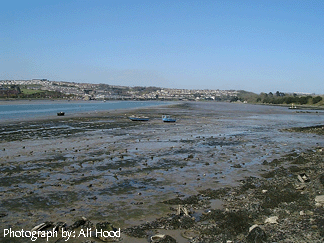
| Above Laira Bridge the valley widens and the river channel shallows abruptly. Two wide bays, one on each side, were reclaimed by the erection of embankments early in the nineteenth century. The reclaimed land on the east side, known as Chelson Meadow, is drained by a series of ditches which harbour a characteristic brackish water fauna, grading inland into that of fresh water. The existing stretch of Laira Estuary includes some extensive stretches of soft mud containing a large ingredient of china clay washings carried down by the Torry and Plym. The fauna of the mud, in so far as it is known, resembles that of the Tamar mud-flats. At the head of the estuary, in the region of Marsh Mills, the dwindling tidal zone is heavily banked with white clay, in spite of which dense populations of crustaceans (especially Gammarus species) and the mollusc Potamopyrgus jenkinsi, support themselves. |
| Updated information | No updated information |
| Species List | No information available. |